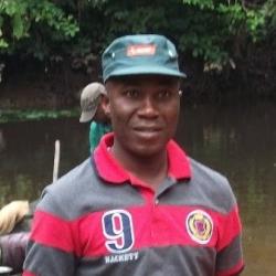
I have a strong academic expertise in geospatial sciences. I hold a Bachelor’s Degree in Geography and Planning, a Master’s Degree in Geographic Information Systems (GIS), and a PhD in Earth Observation from the University of Sheffield, supervised by Prof David Edwards and Dr Rob Bryant.
My research centres on leveraging remote sensing technology to address critical environmental issues, specifically quantifying mining-induced deforestation and forest degradation in sub-Saharan Africa. I use satellite imagery and other remote sensing tools to assess changes in forest cover, allowing me to track deforestation rates and identify degraded forest areas.
In addition, my research involves quantifying forest carbon stocks, a vital area of study in the context of climate change. Forests play a major role in storing carbon, which helps to offset greenhouse gas emissions. By accurately measuring the carbon stored in forests, my research contributes to the global effort to mitigate climate change and informs sustainable forest management practices. Through my work, I aim to provide insights and tools that support conservation, policymaking, and effective environmental monitoring.

